Issyk-Kul covers 6,236 km² at about 1,607 metres, between two ranges of the Tian Shan: the Kungey Ala-Too on the north side and the Terskey Ala-Too on the south. It is about 180 km long and up to 668 metres deep. The water is slightly salty, so the open lake doesn’t freeze, and only a few shallow bays ice over in cold winters.
The two shores are quite different. The north shore, around Cholpon-Ata, is the resort side, with sandy beaches and Soviet-era sanatoriums next to new hotels. The south shore has fewer resorts and more open country: red canyons, yurt camps and the eagle hunters of Bokonbaevo. Karakol, at the eastern end, is the base for the mountain valleys.
We have listed 13 places in the order you reach them on a loop from Bishkek: the north shore, then Karakol and the east end, then back west along the south shore. For a shorter overview, see Issyk-Kul in our 25 best places to visit in Kyrgyzstan.
In this guide
Map of places around Issyk-Kul
The north shore
From Balykchy the main road follows the north shore to Cholpon-Ata, about 250 km from Bishkek. This is the busy side of the lake in summer, with most of the beaches and hotels.
1Cholpon-Ata
The north shore’s beach town
Cholpon-Ata is the main resort on the lake, a town of sanatoriums, guesthouses and sandy beaches about 250 km by road from Bishkek. Its name joins the Kyrgyz words for the morning star and ‘father’.
The beaches are public. Resort fences along the shore came down on presidential orders in 2023 and again in 2025, and charging people to reach a public beach is illegal. Sunbeds and umbrellas still cost extra.
The water is warmest in July and August, when the surface averages about 20 °C, and the beach season runs from late June to the end of August. Cholpon-Ata hosted the first three World Nomad Games, and its hippodrome held the closing ceremony of the sixth in September 2026. Two of the sights below, the petroglyphs and Ruh Ordo, are within 4 km of the centre.
- Best for
- Beaches and a base for the north shore
- Getting there
- Marshrutka from Bishkek’s municipal bus station, 400–600 som (July 2026)
- Swimming
- Late June to late August
- Where
- Cholpon-Ata centreOpen in Maps
Details checked November 2026
View this post on Instagram
2Cholpon-Ata petroglyphs
Ancient carvings on a boulder field above town
On the slope just above Cholpon-Ata, a 42-hectare field of boulders is covered in carvings of hunting scenes, animal fights and symbols. The oldest date from the second millennium BC, and well over a thousand carved stones have been registered.
The field is an open-air branch of the Issyk-Kul history museum, with a ticket hut at the gate. Entry was 80 som in 2025. A full round of the marked stones takes about an hour and a half.
The entrance is at the top end of the old airport runway, about 3 km from the bus station, and there are no signs, so a taxi is the easy way. Vandalism has damaged some of the stones, so look at the carvings but don’t touch them or climb on them.
- Entry
- 80 som (2025)
- Time needed
- About 1.5 hours
- Where
- Ticket hut at the top of the old runwayOpen in Maps
Details checked November 2026
View this post on Instagram
3Ruh Ordo
A lakeside park built around Chingiz Aitmatov
Ruh Ordo is a 4.5-hectare park on the shore at the eastern edge of Cholpon-Ata, named after the writer Chingiz Aitmatov. It has an Aitmatov house-museum, sculptures of characters from his novels, statues of Kyrgyz khans and Manas reciters, and five chapels for Islam, Judaism, Catholicism, Orthodoxy and Buddhism.
The concert hall’s stage opens onto a view of the lake. The park began as a private project and became state property in December 2023.
Foreign visitors paid 500 som in May 2026. It is 2.4 km from the bus station, a short taxi ride.
- Entry
- 500 som for foreign visitors (May 2026)
- Best for
- An hour or two in Cholpon-Ata
- Where
- Eastern edge of Cholpon-AtaOpen in Maps
Details checked November 2026
View this post on Instagram
4Grigorievka Gorge
Spruce forest and a chain of small lakes
The Chon-Ak-Suu gorge, usually called the Grigorievka gorge after the village at its mouth, runs 35 km up into the Kungey Ala-Too about 35 km east of Cholpon-Ata. It is narrower, rockier and more forested than the Semenovka gorge next door.
Three small lakes sit along the river: the lower one in the first part of the valley, the middle one near the At-Jailoo summer pastures, and the upper one about 6 km further on. Above it, at around 3,500 metres, the forest gives way to alpine meadow. In summer there are yurts to stay in.
A dirt road runs up the valley and you only need a 4x4 for the upper part. The village is about 45 minutes by car from Cholpon-Ata. Litter and campfires are a problem here, so take your rubbish back down.
- Best for
- A day in the forest, or a night in a yurt
- Getting there
- About 45 minutes by car from Cholpon-Ata
- Where
- Lower lake, Chon-Ak-Suu gorgeOpen in Maps
Details checked November 2026
View this post on Instagram
Karakol and the east end
Karakol sits near the eastern tip of the lake at the foot of the Terskey Ala-Too. The valleys south of town are where most people go hiking.
5Karakol
The mountain town at the east end
Karakol is the capital of Issyk-Kul Region, a town of around 80,000 people, and it is where you sleep before heading into the valleys to the south. It is about 400 km from Bishkek, 6 to 7 hours by marshrutka. Asman Airlines also flies from Bishkek in about 40 minutes, at a fixed fare of 4,000 som (2026).
Holy Trinity Cathedral was consecrated in 1895, a wooden church on a brick base that replaced one destroyed by an earthquake. In Soviet times it lost its bell tower and crosses and was used by a children’s sports school, and it went back to the church in the early 1990s. Women cover their heads, and scarves are left at the door.
The Dungan Mosque was finished in 1910 to a design by an architect from Beijing, and its beams sit in grooves rather than being nailed. Visitors paid 20 som in 2025, and women are lent a hooded coat. The town itself is being rebuilt: the history museum is closed for reconstruction, and the central square and many streets are being redone through 2026.
- Best for
- A base for the mountains and two historic buildings
- Altitude
- About 1,750 m
- Getting there
- Marshrutka from Bishkek, 6–7 hours, from 500 som (2025)
- Where
- Holy Trinity CathedralOpen in Maps
Details checked November 2026
View this post on Instagram
6Jeti-Oguz
Red cliffs and a valley walk
About 30 km west of Karakol, the Jeti-Oguz river cuts through a wall of red conglomerate. One long ridge of it is the Seven Bulls, and a nearby split cliff is the Broken Heart.
Past the rocks is the Jeti-Oguz kurort, a spa village at about 2,200 metres with hot mineral springs. The sanatorium was handed to the presidential affairs department in 2025 and is being rebuilt, with the work due to finish in 2026, so check that it’s open before planning a stay.
Walk on past the Seven Bulls and up the valley for about 3 hours to reach Kok-Jaiyk, a wide meadow known as the Valley of Flowers. Marshrutka 372 runs from Karakol’s Ak-Tilek bazaar every 30 minutes, 07:00–18:30, and costs from 100 som (2025). In summer some buses stop at Jeti-Oguz village, 15 km short, so check the bus says ‘Kurort’.
- Best for
- Half a day from Karakol, or a walk to Kok-Jaiyk
- Getting there
- Marshrutka 372 from Karakol, from 100 som (2025)
- Where
- The Seven Bulls rocksOpen in Maps
Details checked November 2026
View this post on Instagram
7Altyn-Arashan
Hot springs at the end of a rough track
Altyn-Arashan is a valley of spruce forest, guesthouses and hot springs at about 2,500 metres. The only road in is a 16.7 km track up from the Ak-Suu side. It is too rough for ordinary cars, so you either walk it, which takes 4 to 7 hours uphill, or ride in one of the old Soviet UAZ vans that run the route.
A UAZ costs about 8,000 som one way for the whole van, or 1,500–3,000 som a seat when shared (2026). Expect to pay a park entry fee at the checkpoint at the bottom of the valley.
The springs come out at up to about 40 °C. Guesthouses have their own pools in wooden sheds, and two free covered pools sit by the river below them. Marshrutka 350 from Karakol’s Ak-Tilek bazaar towards Ak-Suu passes the turn-off. It runs every 10 minutes from about 07:20 and costs from 50 som, plus 30 som for a big pack (2025).
- Best for
- An overnight with a hot soak
- Altitude
- About 2,500 m
- Getting there
- Marshrutka 350 from Karakol, then walk or take a UAZ
- Where
- Guesthouses in the valleyOpen in Maps
Details checked November 2026
View this post on Instagram
8Ala-Kul
The lake above the pass
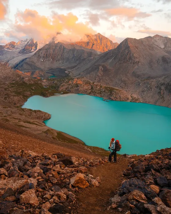
Ala-Kul is a turquoise lake at about 3,530 metres, reachable only on foot. Most people walk it as a loop: up the Karakol gorge to the lake, over a pass of about 3,860 metres, then down the Keldike valley to Altyn-Arashan.
On the classic route you camp in the Keldike valley at about 3,200 metres, then walk 11 km and drop 1,100 metres to Altyn-Arashan, so the hot springs come at the end. The whole loop from the Karakol gorge to Ak-Suu is about 50 km and takes 2 to 4 days.
You pay a park fee at the Karakol gorge gate. The climb to the pass is steep, so if you haven’t trekked at this altitude before, go with a guide: Destination Karakol, the town’s tourist office, lists guided treks.
- Best for
- A 2–4 day trek, ending at Altyn-Arashan
- Altitude
- About 3,530 m; pass about 3,860 m
- Where
- Above the Karakol gorgeOpen in Maps
Details checked November 2026
View this post on Instagram
The south shore
The road from Karakol back to Balykchy follows the south shore for 141 km, and by mid-2026 its rebuild as a four-lane highway was nearly finished. There are fewer resorts on this side, and more canyons, yurt camps and small villages.
9Barskoon Gorge
Waterfalls and a Gagarin memorial
The Barskoon gorge climbs south from the village of Barskoon into the Terskey Ala-Too. Its road is the supply route to the Kumtor gold mine, so expect heavy trucks, but it is in good condition, and the waterfalls are 18 km from the village.
There are four named falls: Tears of the Snow Leopard, Beard of the Aksakal, Splashes of Champagne and Manas’s Cup. The main cascade is 24 metres high, and a steep trail of about 3 km, with 370 metres of climbing, leads past the smaller falls to it. Yurt cafes near the falls serve food in summer.
Yuri Gagarin came here in August 1964 while staying at the military sanatorium in Tamga. A stone head of him stands by the road, with a second memorial nearby. Above it the road heads for the border zone, and you need a permit to go beyond the Kara-Say post. A taxi from Barskoon village to the falls and back, with a couple of hours’ wait, cost 1,600 som in 2026.
- Best for
- A half day of waterfalls
- Getting there
- Taxi from Barskoon village, about 20 minutes
- Where
- Manas’s Cup waterfallOpen in Maps
Details checked November 2026
View this post on Instagram
10Tamga and Kaji-Say
Quieter beaches on the south shore
Tamga is a small village with a military sanatorium, beaches to the west and about two dozen guesthouses and camps. The sanatorium was built for Soviet officers and later hosted cosmonauts, and its 1970s mosaics and reliefs are by Valentin Barskov, who also carved the Gagarin head in Barskoon.
In the Tamga gorge above the village, 6 km by road, three boulders carry the Buddhist prayer ‘Om mani padme hum’ in Tibetan script. One study dates them to the 7th to 9th centuries, which would make them the earliest known Tibetan inscriptions in Central Asia, though other sources place them much later.
Kaji-Say, 37 km west, has beaches on the lake north of the village. It grew up around a Soviet coal and uranium works. The tailings, about 3 km from the village, were made safe in 2019, and demolition of the old plant buildings began in 2025.
- Best for
- A quiet beach day
- Getting there
- On the south-shore road, 88 km from Karakol
- Where
- Tamga villageOpen in Maps
Details checked November 2026
View this post on Instagram
11Skazka Canyon
Red rock shapes above the shore
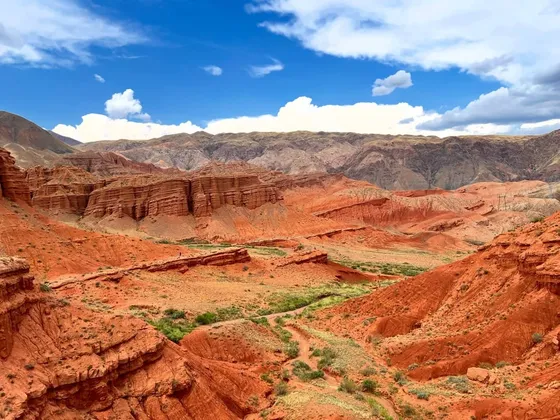
Skazka is a small canyon of eroded red clay and rock just inland from the village of Tosor, between Kaji-Say and Tamga. Its best-known formation is a long ridge called the Chinese Wall. Paths wind between the other shapes, and several viewpoints look back over the lake.
Expect to pay 50–100 som each at the barrier (2026). There are trail boards with walking times, and a yurt camp at the entrance.
The canyon is under pressure. In May 2026 the head of the state tourism agency said it was being worn down by visitor numbers, and proposed moving most activity to its lower part. Stay on the paths and take your rubbish with you. From Bokonbaevo it is about 34 km, roughly 40 minutes by car.
- Entry
- 50–100 som (2026)
- Getting there
- Turn off the main road at Tosor
- Where
- Above Tosor, south shoreOpen in Maps
Details checked November 2026
View this post on Instagram
12Bokonbaevo and the eagle hunters
Golden eagles on the south-west shore
Bokonbaevo, the seat of Ton District, is the place on the lake to see berkutchi, the hunters who train golden eagles. A demonstration takes one to two hours and is booked locally, often the day before. In early 2026 one cost 2,500 som per person, including transport from town. Agree the price before it starts.
On the first Saturday of August the town hosts the Salbuurun festival, with eagles, taigan hounds, archery on horseback and wrestling. It fell on 1 August in 2026 and 2 August in 2025.
Several yurt camps sit on the shore north-east of town, among them Bel-Tam, 8.5 km away. Bokonbaevo is about 260 km from Bishkek by road and 30 km from Kyzyl-Tuu, the next stop.
- Eagle demonstration
- About 2,500 som per person (early 2026)
- Getting there
- Marshrutka from Bishkek’s municipal bus station
- Where
- Bokonbaevo, south-west shoreOpen in Maps
Details checked November 2026
View this post on Instagram
13Kyzyl-Tuu
The village of yurt makers
Most households in Kyzyl-Tuu, 30 km west of Bokonbaevo, make yurts: the wooden frame and the tunduk, the crown at the top, as well as felt coverings, shyrdak carpets and chi reed screens. A couple takes about two months to make one, and village yurts have been sold to Turkey, Tajikistan and the USA.
Yurt makers from the village won both the best-yurt contest and the speed-building contest at the 2026 World Nomad Games. The fastest team put a yurt up in 6 minutes 48 seconds.
Some workshops take visitors who want to watch or learn, and a shop in the village sells yurts, carpets and felt souvenirs. Kyrgyz and Kazakh yurt-making has been on UNESCO’s intangible heritage list since 2014.
- Best for
- Seeing yurts being made
- Getting there
- Just off the south-shore road, 30 km west of Bokonbaevo
- Where
- Kyzyl-Tuu villageOpen in Maps
Details checked November 2026
View this post on Instagram
More around the lake
Five more stops if you have extra time.
- Przhevalsky memorial: the grave of the Russian explorer Nikolai Przhevalsky, who died in Karakol in 1888, stands on the shore about 12 km north-west of town, with a bronze eagle monument from 1894 and a small museum. Entry was from 100 som in 2025, and it opens daily 09:00–17:00.
- Karakol animal market: the Sunday livestock market has moved from its old site to the M-060 highway, about 5 km north of the centre. It runs 07:00–11:00, and the earlier you get there the more there is to see. Marshrutka 101 goes there.
- Semenovka gorge: the next valley east of Grigorievka is about 30 km long, with grassier slopes and summer yurts serving beshbarmak and kumis. Its Kyrchyn pasture held the World Nomad Games ethno-village in 2018 and 2026, and the road up was asphalted in 2026. The village at its mouth was officially renamed Kozhoyar-Ata in 2024, though signs still say Semenovka.
- The salt lake: a small, very salty lake about 1 km inland near Kara-Koo, 10 km by road from Kyzyl-Tuu, salty enough to float in, with black mud on the shore. Visitors paid 150 som each at the barrier in July 2025. You rinse off in Issyk-Kul, a few minutes’ walk away.
- Bosteri: the resort village just east of Cholpon-Ata, with the lake’s busiest beaches and an amusement park. Its big Ferris wheel was ordered to stop in July 2025 until it passed a technical inspection, so check it’s running before you go.
Tips for visiting Issyk-Kul
- Use the right bus station. Buses and marshrutkas to both shores leave from Bishkek’s municipal bus station at Alma-Atinskaya 1/1, on the northern bypass road. The Western bus station closed in October 2024. On the way, the Kok-Moinok canyons make a good stop if you’re driving.
- Take the summer train. In 2026 a train ran from Bishkek-2 station to Balykchy from 5 June to 13 September, daily from late June. It left at 08:06 and reached Balykchy at 12:12, and a seat cost 180 som in cash or 150 by card. A marshrutka from Balykchy on to Cholpon-Ata cost about 200 som. The 2027 dates haven’t been announced yet.
- Fly in summer. Tamchy airport on the north shore had summer 2026 flights from Almaty, Astana, Osh, Batken and Tashkent. Karakol airport has Asman Airlines flights from Bishkek in both summer and winter.
- No eco fee for cars. The old entry fee for cars at Balykchy was abolished in 2013, and the checkpoint building was demolished in 2025. Some sites, such as Skazka and the salt lake, charge their own small fees.
- Permits are only for the far end. You don’t need one for the shore, the towns or the usual valleys. You do for Enilchek, Khan Tengri base camp and the road beyond the Kara-Say post in the Barskoon gorge. A licensed agency can arrange it, and it takes about a week.
- Winter is for skiing. The water is about 4 to 5 °C in January and February. The Karakol ski base opened its 2025/26 season on 30 November, and the new Ala-Too Resort at Jyrgalan is due to open on 1 December 2026.
Questions people ask
How do you get from Bishkek to Issyk-Kul?
By marshrutka or bus from the municipal bus station on Bishkek’s northern bypass road, by shared taxi, or in summer by train to Balykchy. Cholpon-Ata is about 250 km by road and Karakol about 400 km, 6 to 7 hours by marshrutka.
When can you swim in Issyk-Kul?
From late June to the end of August. The surface averages about 20 °C in July and August, and by September it is too cold for most people.
Does Issyk-Kul freeze in winter?
No. The water is slightly salty, at about 6 grams per litre, so the open lake stays unfrozen. Only some shallow bays ice over in cold winters.
Which is better, the north or the south shore?
The north shore around Cholpon-Ata has the sandy beaches, resorts and most of the hotels. The south shore is quieter, with Skazka canyon, yurt camps and the eagle hunters of Bokonbaevo. Karakol, at the eastern end, is the base for hiking.
Do you need a permit to visit Issyk-Kul?
Not for the lake, the towns or the usual valleys such as Jeti-Oguz, Altyn-Arashan and the Barskoon waterfalls. You need a border-zone permit for Enilchek, Khan Tengri and the road beyond the Kara-Say post in the Barskoon gorge.
Is there an eco fee to enter Issyk-Kul?
No. The entry fee for cars was abolished in 2013. Some sites, such as Skazka canyon and the salt lake, charge their own small fees.